
Manitoba Randonneurs Routes
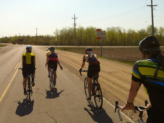
We are proud to bring you the best road cycling routes in Manitoba (with a little gravel mixed in). Follow the little red lines on the maps to discover beautiful parts of Manitoba that are a little off the beaten trail.
All participants must be 2025 members of the Manitoba Randonneurs prior to ride registration.
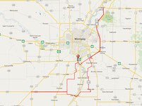
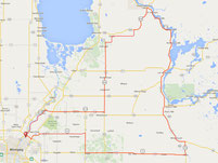
See all routes in detail, and import the route to your GPS device on ridewithgps.
Marchand 200
First run in 2017 as a safer alternative to the too-close-to-Steinbach Latke 200. Our only out-and-back style route, heading out from Winnipeg to Marchand and back.

Ste Gen 200
Added in 2017 to replace the infamous Spicy Radish 200. Don't underestimate the help of your cue sheet on this twisty route.

Start/end location:
2001 Henderson Hwy (Mountain Bean)
Park on Bonner Ave
Gravel Sand Hills 200
That's right: gravel. First run official run will be in 2023 but the test run went amazing with some beautiful roads and views. Also now with less murder dogs!

Start/end location:
2001 Henderson Hwy (Mountain Bean)
Park on Bonner Ave
Gravel Parkway 200
That's right: gravel. Known for the occasional 100% DNF rate. Of its 18 starters over the years, only four have finished.
Gull Lake 200
New for 2023! Designed as a 200km companion to the Great Falls 300. Named after Gull Lake near the halfway turnaround, which is the freshwater source for the Brokenhead Wetlands ecological area.

Start/end location:
2001 Henderson Hwy (Mountain Bean)
Park on Bonner Ave
Roland 200
Designed to run along the start of the Storm watch 400, this route is for those that want to ride but maybe not quite ready for a 400.

Lowe Farm 200
A companion ride that follows the Can-Am 400 but changes direction in Grunthal for a tour of Canola fields, the Rat River, the Marsh river and Red river. A quick visit to Lowe farm and then home.

Great Falls 300
A contender for the most beautiful route of the Manitoba Randonneurs. We recommend lunch in Whitemouth.
Start/end location:
2001 Henderson Hwy (Mountain Bean)
Park on Bonner Ave
Forest Fire 300
Journey through the woodlands of southeast Manitoba. Added in 2015, this route became an instant favourite.

Neepawa 300
Test your climbing with this beautiful ride through Riding Mountain. With 1550M of elevation you have lots of time to enjoy the scenery.

Rivers & Roads Gravel 300
Our first Gravel 300! A challenging but beautiful trip through Manitoba history. Head south on an 'express' Crow Wing Trail, follow the shoreline ridges of Lake Agassiz to Ste Anne, then ride the Dawson Trail back to Winnipeg. Even with 65kms of pavement, this brevet will take both the Head and the Heart to complete within the Audax Association's 20hr cutoff.

Can-Am 400
As the name implies, the Can-Am 400 enters USA to visit Roseau, MN. Passports are required for successful completion.

Can-Am 400 (no Am)
The modified Can-Am, a result of Covid border closures.

Storm Watch 400
The first group to ride this route in 2016 was hit hard by southern Manitoba's fierce summer storms as they circled the hills of Pembina Valley.

Leon Lights 600
Our beloved 600 km classic. Named for the eerie red windmill lights when passing through St Leon after the sun has set.

Glenboro 600
A companion ride designed to ride out with the Riding Mountain 1000 which turns back for home at Glenboro.

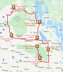
Moon Lake 600
A companion ride to the Dauphin 1000 that tours both Riding mountain and Duck Mountain. The Ride ends at beautiful Moon lake for those worried about timings and then you can take a relaxed ride back to Dauphin (all downhill) what could be better.
Riding Mountain 1000
An epic Manitoban adventure. This 75 hour time-limited ride is a journey of a lifetime.

Dauphin 1000
A new route for 2022 that features our Riding mountain national park and also Duck mountain

Swan River 1200
The first 1200 hosted by the Manitoba Randonneurs debuted in 2016. More details on the Swan River 1200 page.
